
|

|
Basic Information
Total Area: 799,380 sq km
Bordered By: Malawi, South Africa, Swaziland, Tanzania, Zambia, Zimbabwe, and the Indian Ocean.
Climate: Mozambique has a tropical to subtropical climate with two main seasons: the rainy season and the dry season. Rainfall is heaviest along the coast, and it decreases further north and south.
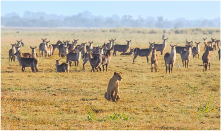
Terrain: Mozambique's terrain is mostly coastal lowlands, though there are uplands in the center, high plateaus in the northwest, and mountains in the west.
Point of Lowest Elevation: Indian Ocean (0 m)
Point of Highest Elevation: Monte Binga (2,436 m)
- Land Area: 786,380 sq km
- Water Area: 13,000 sq km
Bordered By: Malawi, South Africa, Swaziland, Tanzania, Zambia, Zimbabwe, and the Indian Ocean.
- Country Boundaries: 4,783 km
- Coastline: 2,470 km
Climate: Mozambique has a tropical to subtropical climate with two main seasons: the rainy season and the dry season. Rainfall is heaviest along the coast, and it decreases further north and south.
Terrain: Mozambique's terrain is mostly coastal lowlands, though there are uplands in the center, high plateaus in the northwest, and mountains in the west.
Point of Lowest Elevation: Indian Ocean (0 m)
Point of Highest Elevation: Monte Binga (2,436 m)

|
|
